By Vanessa Whiteside on October 22, 2025
Kansas in the Center: 3 Must-See Roadside Landmarks That Attract Visitors
Most people know Kansas is smack dab in the middle of the United States on a map, but what they may not know is that there are three roadside markers that pinpoint its center in more specific ways. Which one of these landmarks will you find next?
Center of Google Earth
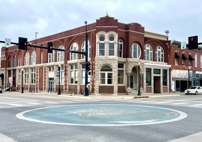
Chanute
Dan Webb, a Google Software Engineer who was born and raised in Chanute, programmed mapping software to showcase the Southeast Kansas town as the Center of Google Earth when viewed on Apple products via the 3D View tab. According to Webb’s blog, he chose Chanute as the center for two reasons: 1) it’s near the center of the 48 contiguous United States, and 2) his coworker added Lawrence to the Microsoft Windows version of Google Earth a few months earlier.
In 2010, Main and Lincoln Streets were barricaded so a 30-foot surface mural replicating a Google Earth screenshot could be painted in the middle of downtown. A star denotes the exact spot within the United States where Chanute is positioned on the map. During a no-traffic moment, one could stand in the center of the Center of Google Earth.
Center of Google Earth
Main and Lincoln Streets, Chanute
Website
Geographic Center of the 48 Contiguous States
Lebanon
The Geographic Center of the 48 Contiguous States is just outside of Lebanon, marked by a stone monument with an American flag installed in 1941 by the Hub Club. Recalculations actually put the center on a hog farm, but the landowner didn’t want to turn it into a tourist attraction. Visitors can snap a photo at Geographical Center Park, which also includes a small, white chapel.
Lebanon’s landmark has attracted droves of curious road-trippers, including rock legend Bruce Springsteen, who starred in a JEEP® Super Bowl LV commercial filmed on location. The singer enters the chapel, sits on one of the pews, and says, “It never closes. All are more than welcome to come meet here, in the middle.”

Geographic Center of the 48 Contiguous States
High 281 North to HWY 191 West on 191, Lebanon
Website
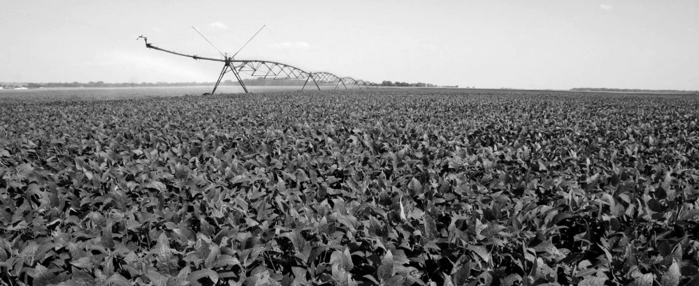
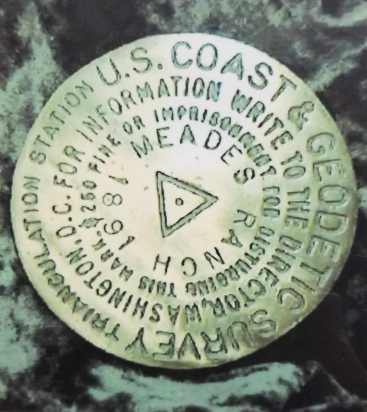
Geodetic Center of North America
Osborne
The city of Osborne is surrounded by grasslands, and one particular spot brings people to the area more than any other. The original marker for the Geodetic Center of North America was identified at the Meades Ranch in 1891, a datum point surveyors designated with a bronze disc on a pad of concrete. Years later, the Meades Ranch Triangulation Station was chosen as the United States standard horizontal datum, or the point relative to which all land measurements in the nation were made.
The site is approximately 18 miles southeast of Osborne on private property, and is not open to tour. However, curious minds can seek out a replica of the marker at Roadside Park and learn more about it at the Kansas Historical Marker.
 Geodetic Center of North America
Junction at Hwy 24 and 281, Obsorne
Website
YOU MAY ALSO ENJOY: